


Small Unmanned Aircraft (SUA)
We introduced the Small Unmanned Aircraft (SUA) technology in 2017 and it was first deployed in taking 360° panorama photos and videos for project planning. The use of SUA is now expanded to various applications such as urgent record surveys, inspections of bridge condition, etc., to facilitate road safety and maintenance.
Video: SUA Application in Inspection of Bridge Structures
Visual Inspection of Highway Structures
One of the SUA application is to assist in visual inspection of highway structures such as bridges. SUA survey was conducted to create a detailed image record of the soffit condition of Kap Shui Mun Bridge and Ting Kau Bridge in 2017 and 2019 respectively. True scale orthophotos and 3D mesh models were created from over 1800 photographs on which simple measurements could be taken. The use of SUA enables detailed inspection of structures with accessibility constraints.
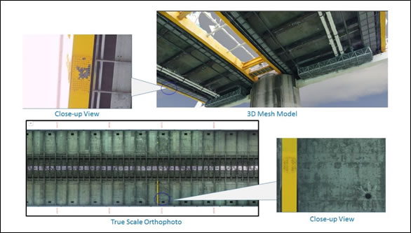
3D Mesh Model and Orthophoto
Part of the Soffit of Ting Kau Bridge
Emergency Survey of Landslide
SUA was deployed in emergency surveys such as landslide at South of Peel Rise in 2019, slope failure at Peak Road in 2021, etc. Vertical and oblique aerial photographs were taken for forming point cloud and 3D mesh model of the sites with high positional accuracy. The surface area of the sites could be promptly measured to facilitate subsequent repair works.
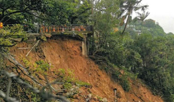
Landslide Slope near Peel Rise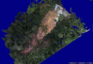
3D Mesh Model of the Landslide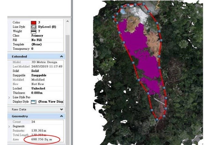
Surface Area Measurement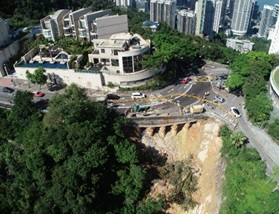
High-definition Photo Taken by SUA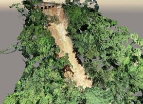
3D Mesh Model of the Collapsed Slope
Taking Progress Photo for Major Road Projects
SUA is widely used in construction progress monitoring of HyD's works projects, such as "Hiram's Highway Improvement Stage 1 – between Clear Water Bay Road and Marina Cove" and "Widening of Western Section of Lin Ma Hang Road between Ping Yuen River and Ping Che Road". Requiring less post processing time, the panoramic photos taken by SUA in several designated locations of the construction sites provided fast and prompt update on the construction progress; and allowed users to see a wider area and clear pictures of the site from a helicopter viewpoint.
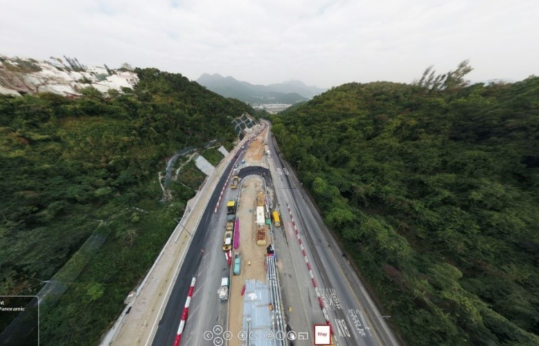 Panoramic Photo of Hiram's Highway Improvement Stage 1 Taken by SUA in Dec 2019
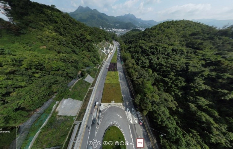 Panoramic Photo of Hiram's Highway Improvement Stage 1 Taken by SUA in May 2022